Location
 |
Just above Algeciras and Gibraltar - the port to Africa - a big natural park stretches far inland on both sides of the A381 highway to Seville. Los Alcornocales Natural Park in the Andalusia province in Spain consists of Mediterranean native forest and is a nice place to explore by foot or bicycle for those who are not in a rush to get to Africa.
Traveling to Jerez de la Frontera? Have a look at traveling in the Cadiz province.
Los Alcornocales Natural Park in Andalusia Spain
Los Alcornocales means “The cork oak Groves” and not surprisingly this tree is a popular inhabitant of this huge natural park. The park is not the classic natural park, it’s resources are used by local cork industry.
 |
| Los Alcornocales National park at the Barbate-Reservoir Andalusia-Spain |
Los Alcornocales is managed by an active park authority with many offices throughout the park. A large visitor center is located Near Acala de los Grazules at the exit of the A381 Autovia.
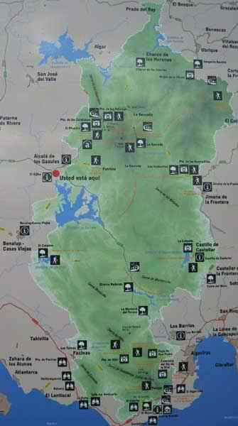
Los Alcornocales Natural Park information
At the visitor center near Acala de los Grazules there’s a map of the whole area, showing what is where. Every entrance on the map has it’s own local sign explaining the trail, duration and what can be done in the park.
 |
|
| Map of the Los Alcornocales National park | |
The A381 has a service road following most of the A381 highway with several exits in Los Alcornocales natural park. The service road takes you to several park entrances of which some have bridges over the A381.
Driving the local roads through the park, one thing stands out big time – the park and private land is vigorously protected by a huge amount of very serious fencing. There’s no mistake about it, either private land owners or park management doesn’t want anyone wandering off in the park outside the official entrances. Specially private land owners in the park area have used every opportunity to place “coto privado de casa” signs at every gate and visible stretch of fence. At least the fencing industry has scored big time in this area.
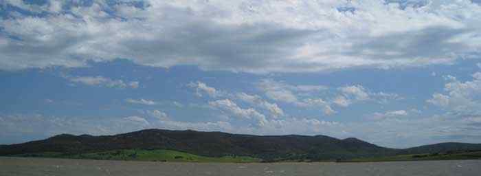
The reservoirs at Los Alcornocales Natural Park
Los Alcornocales has several reservoirs, like the Barbate reservoir, the Celemin reservoir and the Charco Redondo o Palmones reservoir, all located at the south side of the A381 autovia. The reservoirs are mainly used for irrigation of local farm lands. Because of the excessive rains in the winter of 2009/2010, reservoir levels where extremely high. At some places roads and park trails where still flooded in April 2010.
Access to the park and mapped facilities
Parking space for vehicles near the official entrances to the Los Alcornocales natural park is fairly limited. At most entrances parking a car is only possible either at the shoulder of the road. At some spots it’s impossible to park until a few Km’s further down the road. For campers and bigger vehicles there’s usually no space for parking at all.
It seems park authorities have imagined visitors to be dropped of at the park entrances while parking vehicles somewhere else.
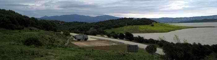 |
| Official permitted parking at the Barbate reservoir in Los Alcornocales National park. |
On the south side of the Los Alcornocales park – below the A381 autovia - there’s 1 official parking space for bigger vehicles. It’s next to the Embalse de Barbate next to the heli pad. Most likely in high season this place is used by those with camper vans / mobile homes / rv’s.
The Tajo de las Figuras cave near Benalup
In April 2010 the Tajo de las Figuras cave entrance was closed. A guard was stationed at the gate, a totally lonely job since there are very little visitors in this time of year. According to the guard the cave where closed since 2007 and seemingly guarded since then. The guard couldn’t give a reason for closure.
Please note that access to the road entrance of Tajo de las Figuras cave is extremely dangerous. The gate is located in a blind curve where local traffic doesn’t expect people to be walking. Also stopping your car at the entrance is very prone to accidents, you can see it only at the last moment. Be careful!
It seems there was an attempt to link the nearby Area Recreactiva Le Celemin with the entrance of the Tajo de las Figuras gate. However the path is nearly gone and one needs to climb fences and reach into private land to get there. At least the route is less dangerous than walking the asphalt road. A big group of Spanish tourists also returned disappointed to Le Celemin after finding out the cave is closed.
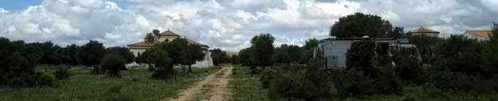
Area Recreativa - Le Celemin in Los Alcornocales Natural Park
Area Recreativa - Le Celemin nearby the Tajo de las Figuras cave is a gem at first sight. It’s a huge terrain with access to the reservoir facilitated with many pick-nick spots. It’s a great place for a day out as many did in the weekend.
 |
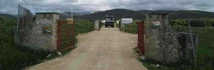
| The gate at Le Celemin at Los Alcornocales National park Andalusia - Spain |
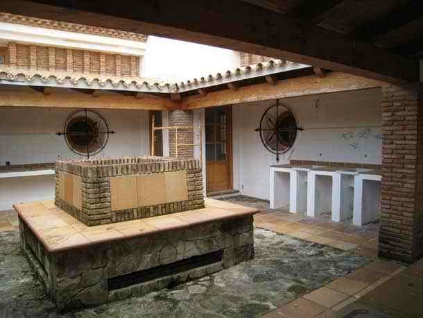
Exploring Area Recreativa - Le Celemin one gets confused after a while. There are 3 fairly new buildings, seemingly unused for several years with almost finished facilities.
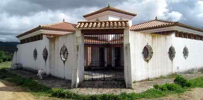 |
| New unused building at Area Recreativa El Celemin in Los Alcornocales National park |
Also the place looks like a campsite with unfinished infrastructure, abandoned for several years. The community website of the nearby town Benalup mentiones Area Recreativa El Celemin as a campsite. After a few hours the place leaves a big question mark.
 |
| New unused building at Area Recreativa El Celemin in Los Alcornocales National park. |
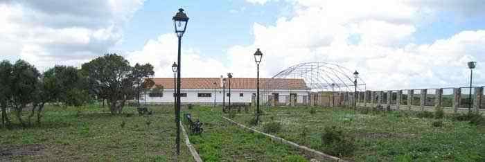 |
| Botanic garden at Area Recreativa El Celemin in Los Alcornocales National park |
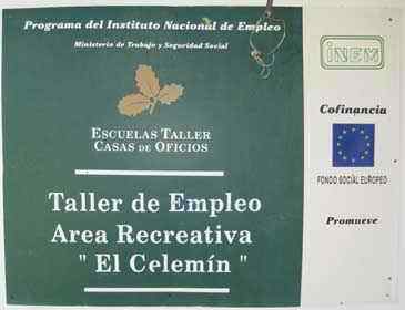
The sign at the entrance building reveals, the place has been a “workshop school” – most likely a practical school – learning a trade by doing.
|
| Employment project at Area Recreativa El Celemin |
Apparently the project received funding from the European Union. The school seems to have never been opened, or the building activity itself was the workshop project? It seems like a big waste of money and resources and one starts to wonder what might have happened here in the first place.
 |
| The Gate closes at closed Campsite Los Alcornocales National park Andalusia-Spain |
Probably as an attempt to protect the new infrastructure from damage, Area Recreativa - Le Celemin is closed from 9pm upto 8am in the morning. Not surprisingly, the back of the buildings – out of public sight - already suffered damage by those trying to get inside.
Saturday afternoon and evenings at Area Recreativa - Le Celemin can be extremely loud because of the local boom-boom squad arriving in cars with high powered audio.
In any case during during the week on workdays Area Recreativa - Le Celemin is a good place to be. Be sure to leave before 9pm because local police roams the park and closes the gate every evening. Park your mobile home, RV or camper van at the Barbate dam about 10 Km north or drive to Benalup and park at the east side of town near a small recreation area.
Also interesting nearby :
Europe's biggest reservoir lake in Portugal