 |
The Garmin Dezl is a navigator made for those driving large vehicles – either commercially or recreational. Here’s an hands-on review of the Garmin Dezl based on 95 hours of driving in European cities and narrow roads with a 12 ton truck.
Garmin Dezl Navigation review summary
Is the Garmin Dezl worth it? Yes – it’s navigation feature has saved fuel and frustration by avoiding roads with height and weight restrictions in Europe. Most important Dezl navigation directions should be clearly taken as a guidance – and definitely CAN NOT be “blindly” relied on in all circumstances. Main reason for this is a lower map quality and sometimes navigation software errors. Most likely other navigators won’t do much better with the same map.
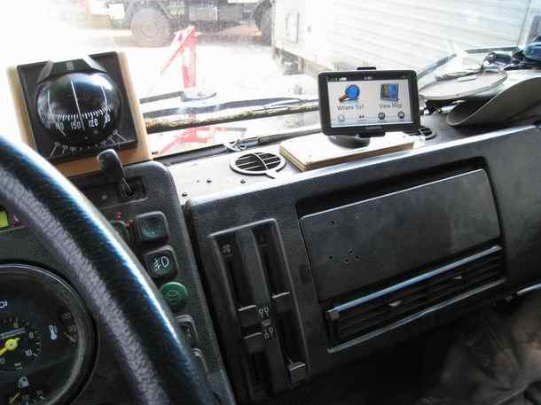 |
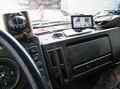
| Garmin Dezl 560LT reviewed in a Mercedes Benz 1719AK truck |
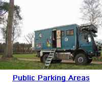
Great Garmin Dezl features are lane assist – warnings for sharp curves, steep ascent and descents, road narrowing and strong side wind. These warnings really matter when driving large vehicles. The loud volume is a plus in older trucks with bigger engine noise. The large display is better visible in truck cabins. The composite video input supports standard CCD cameras for reverse backup or vehicle surveillance when parking at public parking areas.
Overall the Garmin Dezl truck / lorry navigation mode can be improved by avoiding narrow roads when wider roads in the area are available – even when it makes the total distance longer or results in more time driving. Shortest route or fastest route planning simply optimizes too much by taking minor roads into calculation.
Garmin Dezl software issues (V2.50)
Most irritating are occasional short detours from the main route because this route is a few meters less in length only benefiting a few minutes. This occasionally happens on both highways and cities. This sometimes resulted in driving highway slip roads optimizing a few meters in distance. Specially in cities the short detour quirk can lead to dangerous situations because the shorter route from the main route is usually narrower. In most cases this has lead to frustration and huge question marks specially while driving in dense traffic.
Planning very long routes (ie: Berlin - Gibraltar) can best be avoided since the processor isn't fast enough to come up with a route for trucks within a few minutes. Even the fastest PC won't come up with a route this taking height / weight restrictions into account. Specially if the shortest route is set and/or toll road avoidance. Best is setting the destination for the day.
Most wanted features are the ODO meter and fuel counter in (European) truck mode – supporting economical driving. The navigator can see when a stop is made at a fuel station and can ask how much fuel is taken in. The Dezl US version seems to have these features.
Dezl Navigator review approach
This review is written from the perspective of deliberately driving a large and heavy vehicle in city centers, small villages, narrow roads and mountainous terrain.
For those driving vehicles less than 3.5 Ton, 2 meters in height or less than 8 meters in length won’t benefit much from the Dezl. It won’t perform much differently compared to a standard navigation device. Also for those driving a car with caravan above 8 meters in length won’t really notice the difference with the Garmin Dezl since length restrictions on the road are quite rare. Unless of course following road signs for trucks.
 |
 |
 |
The most important road restrictions are height and weight related – with height as the primary parameter above weight. Most height restrictions on the road start from about 2 meters and above in Europe. Relevant weight restriction start from 3.5 Tons and up.
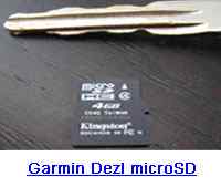
Garmin Dezl navigation maps
The Garmin Dezl provides navigation guidance based on height, weight and length restrictions. Important in this context is map quality. The Garmin Dezl and other navigators read size, weight and time restrictions from the map. Meaning a low quality map makes any size and weight based navigation useless. The Garmin Dezl uses NAVTEQ maps. So part of this review is the quality of the NAVTEQ maps.
It’s obvious that map quality for height and size related navigation decreases outside the regions most driven by truck drivers. For regions outside the western urbanized world a standard navigation device will most likely perform the same.
Garmin Dezl software version review
Garmin Navigation software: Version 2.5
GPS firmware: Version 2.70
Bluetooth formware: Version 5.03 A15
NAVTEQ map: CN Europe 2012.10 ALL
TrafficTrends Europe: Version 4.25
In January 2012 the Garmin Dezl firmware Version 2.7 is released.